

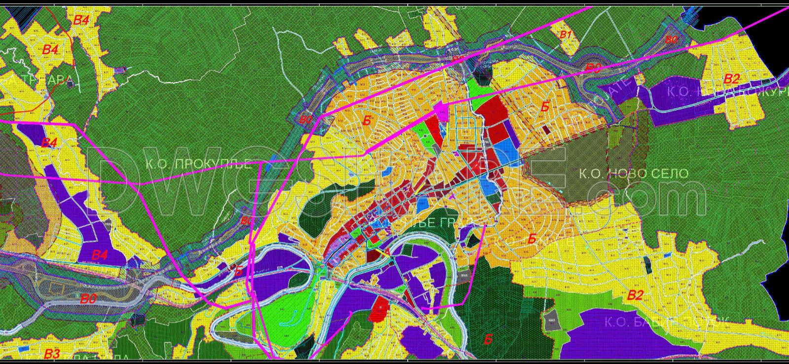
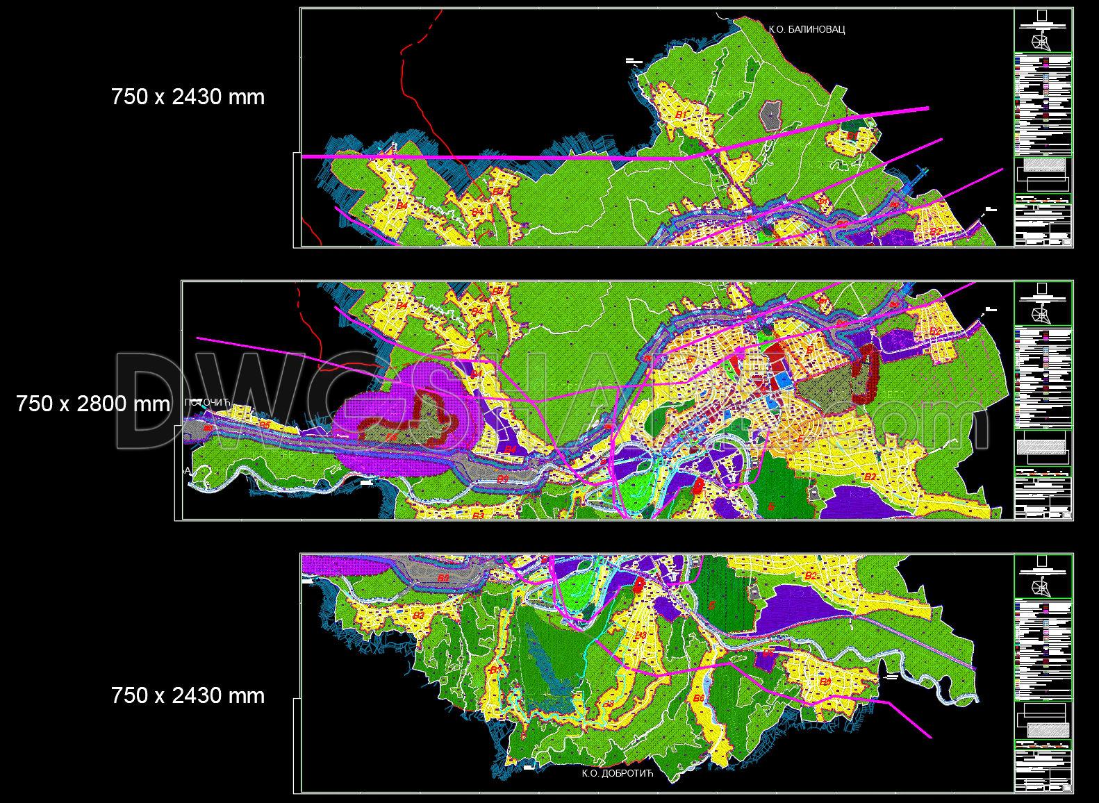
143. Drawing of Plan Boundary and Boundary of the Planned Construction Area with Predominant Land Use
Advertisements
143. Drawing of Plan Boundary and Boundary of the Planned Construction Area with Predominant Land Use
Explore the intricacies of plan boundary drawing with these detailed CAD files that offer a comprehensive view of planned construction areas along with their predominant land usage. Designed with dimensions of 750 x 2430 mm and 750 x 2800 mm, these drawings provide multiple perspectives ideal for understanding complex architectural projects. These CAD drawings delineate various components including land use zones, infrastructure layouts, and natural boundaries, all crucial for precise planning.
The use of CAD drawings like these in architecture and construction enhances accuracy, allows for easy edits, and supports seamless collaboration among team members. They are instrumental in optimizing costs by identifying potential issues early in the design phase. Furthermore, offering these CAD DWG files for free download encourages wide reference and use, supporting both experienced architects and those new to the field.
The integration of these tools into architecture and interior design workflows ensures not only a streamlined process but also the highest standards of project execution. Embrace the benefits of these expertly crafted drawings today, available for free download to refine and elevate your architectural projects.
I also recommend downloading other Urban, Landscaping CAD drawings for your project reference.
- File format: .DWG
- Size: 17 MB
- Source: DWGshare
- AutoCAD platform 2018 and later versions. For downloading files there is no need to go through the registration process
Advertisements