

187. Free Download CAD Land Use and Transportation Planning Map of Duc Giang Ward
Advertisements
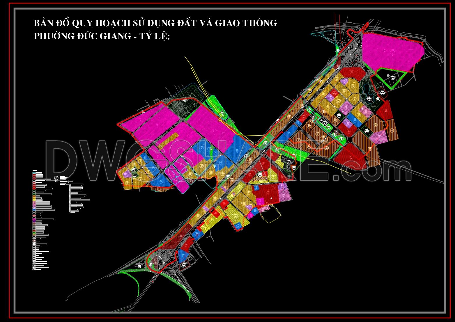
187. Free Download CAD Land Use and Transportation Planning Map of Duc Giang Ward
The CAD Land Use and Transportation Planning Map of Duc Giang Ward presents a vital resource for architects and urban planners. This comprehensive land use planning map is meticulously crafted, offering an insightful overview into the urban layout and transportation networks of Duc Giang Ward. The DWG file provides essential components necessary for effective planning and development.
Key elements included in this planning map are:
Functional land use distribution
Roadway and transportation networks
Plot delineations and zoning areas
Green space allocations and public areas
Infrastructure and utility networks
Detailed grid lines, dimensions, and scale indicators
These features serve critical roles in both design and construction processes. Architects utilize these drawings during the design development phase to ensure that space allocations meet regulatory and practical needs. Interior designers reference these documents when they need detailed technical information about layouts and zoning. For construction teams, the map functions as an indispensable reference for onsite coordination and execution, minimizing errors while optimizing costs.
The practical value of these CAD drawings is significant due to their high technical accuracy and ease of modification. AutoCAD users benefit from the ability to easily adapt and reuse this information for various projects, ensuring improved coordination between design stages and actual construction. This free download provides an excellent base for design reference, allowing users to explore space planning and transportation logistics effectively.
These CAD DWG files, shared freely, offer a wonderful opportunity for professionals and students alike to study sophisticated urban planning methods. They not only provide a detailed snapshot of Duc Giang Ward’s current land use but also serve as a reliable foundation for future design and technical drawing development.
I also recommend downloading other Transport CAD drawings for your project reference.
- File format: .DWG
- Size: 2 MB
- Source: DWGshare
- AutoCAD platform 2018 and later versions. For downloading files there is no need to go through the registration process
Advertisements