

176. Boulevard De Las Naciones Project Subdivision and Landscape Plan AutoCAD Drawing
Advertisements
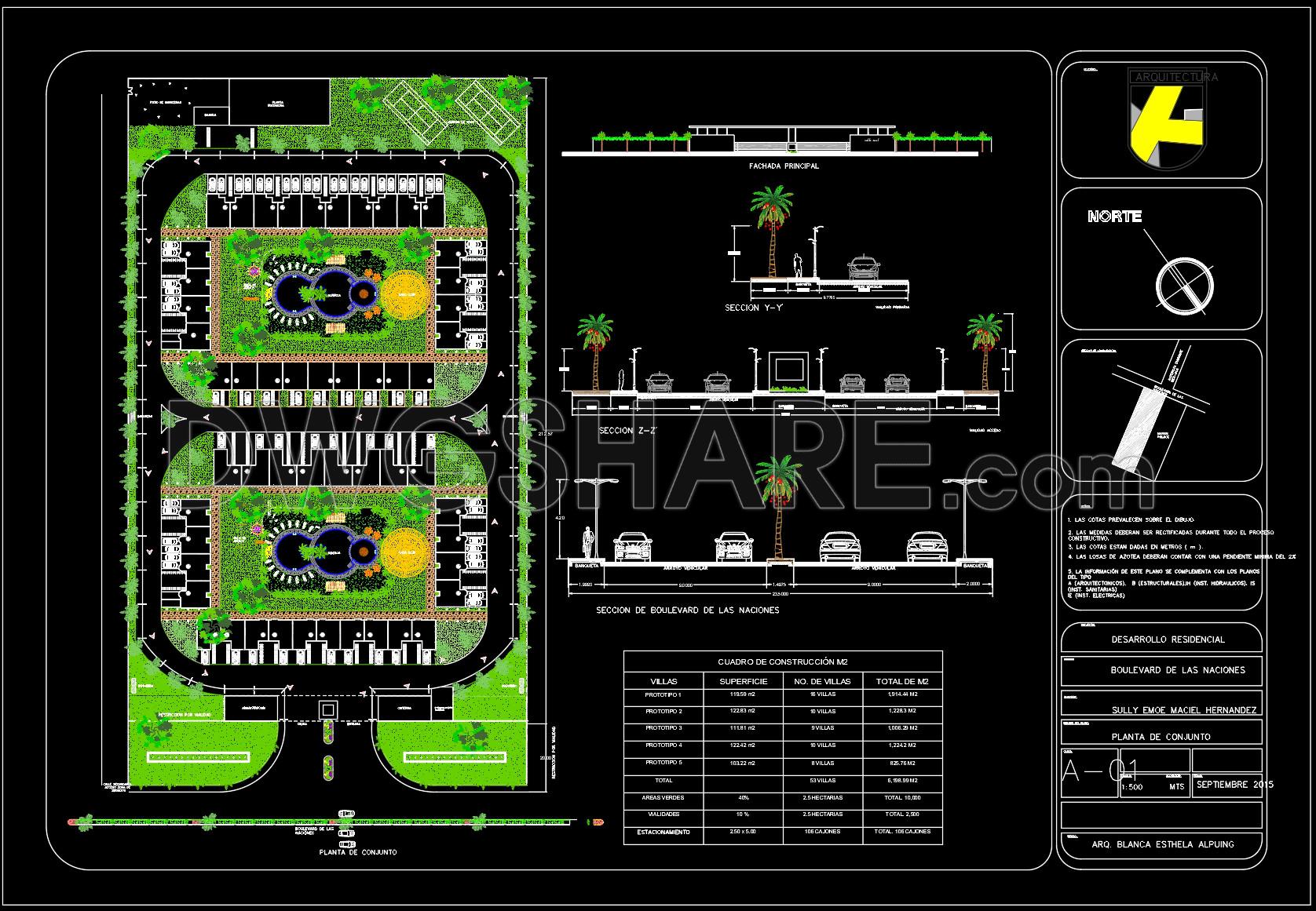
176. Boulevard De Las Naciones Project Subdivision and Landscape Plan AutoCAD Drawing
The CAD drawing presents a comprehensive master plan of a residential development with a clear and well-structured spatial organization. The layout consists of two symmetrical housing clusters arranged along an internal circulation axis, directly connected to the main boulevard. The internal road network is designed as a loop system, ensuring continuous traffic flow and convenient access to each villa lot. At the center of each cluster is a landscaped courtyard featuring water elements, small plazas, and integrated green spaces, creating a focal point for community interaction.
Street elevations and road sections are detailed, illustrating sidewalk levels, carriageways, medians, and tree planting schemes. The construction schedule table summarizes building areas, density, number of units, and green space allocation, supporting effective planning control. Overall, the proposal balances building density, open space, and technical infrastructure, making it suitable for high-quality low-rise residential development.
I also recommend downloading other Urban, Landscaping CAD drawings for your project reference.
- File format: .DWG
- Size: 1.7 MB
- Source: DWGshare
- AutoCAD platform 2018 and later versions. For downloading files there is no need to go through the registration process
Advertisements