

179. AutoCAD Landscape & Architectural Planning – South Lam River New Urban Area
Advertisements
179. AutoCAD Landscape & Architectural Planning – South Lam River New Urban Area
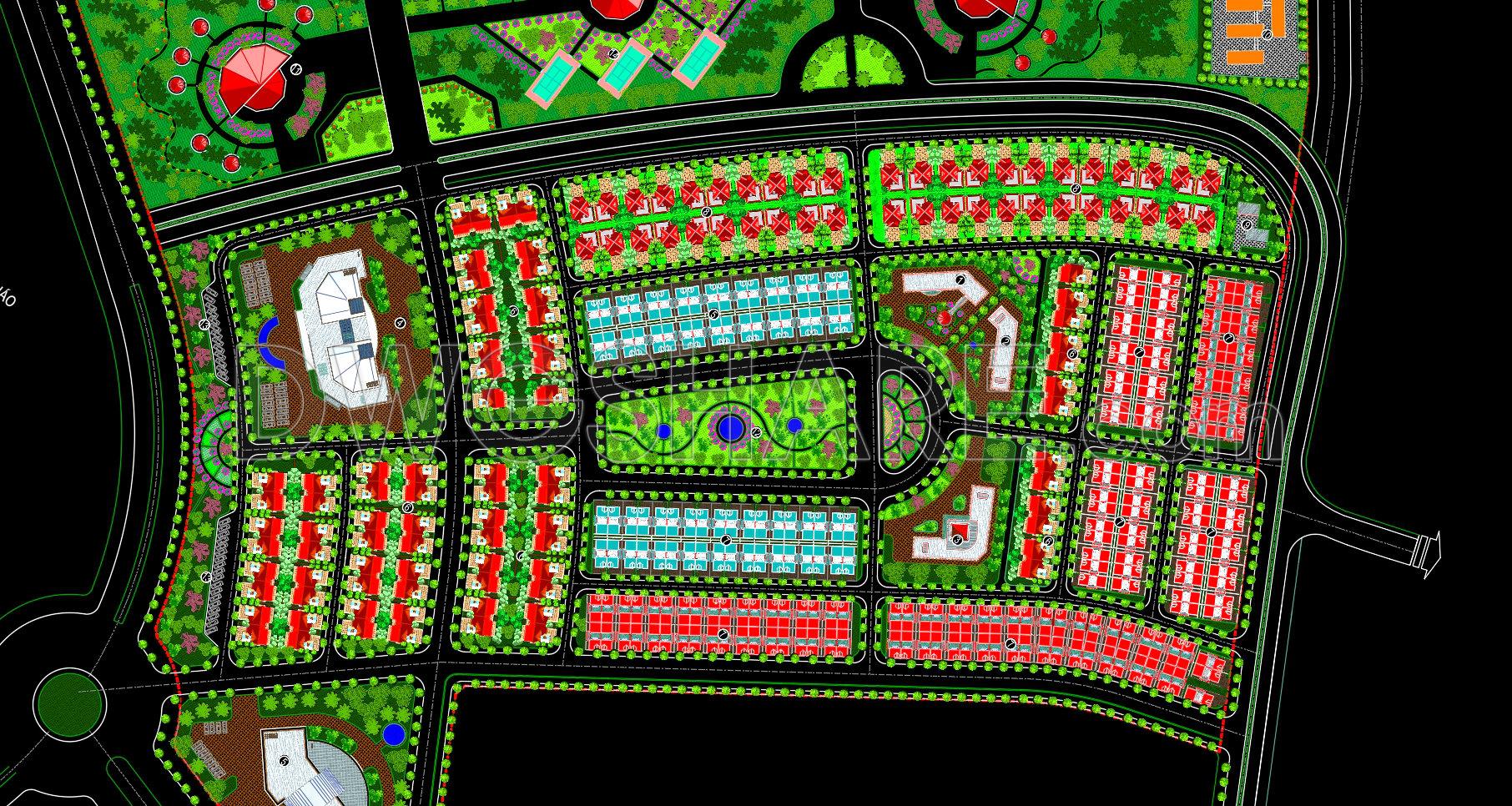
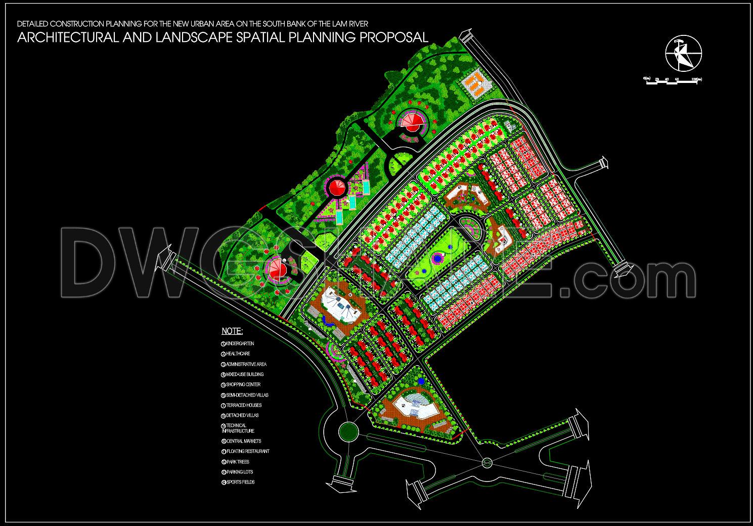
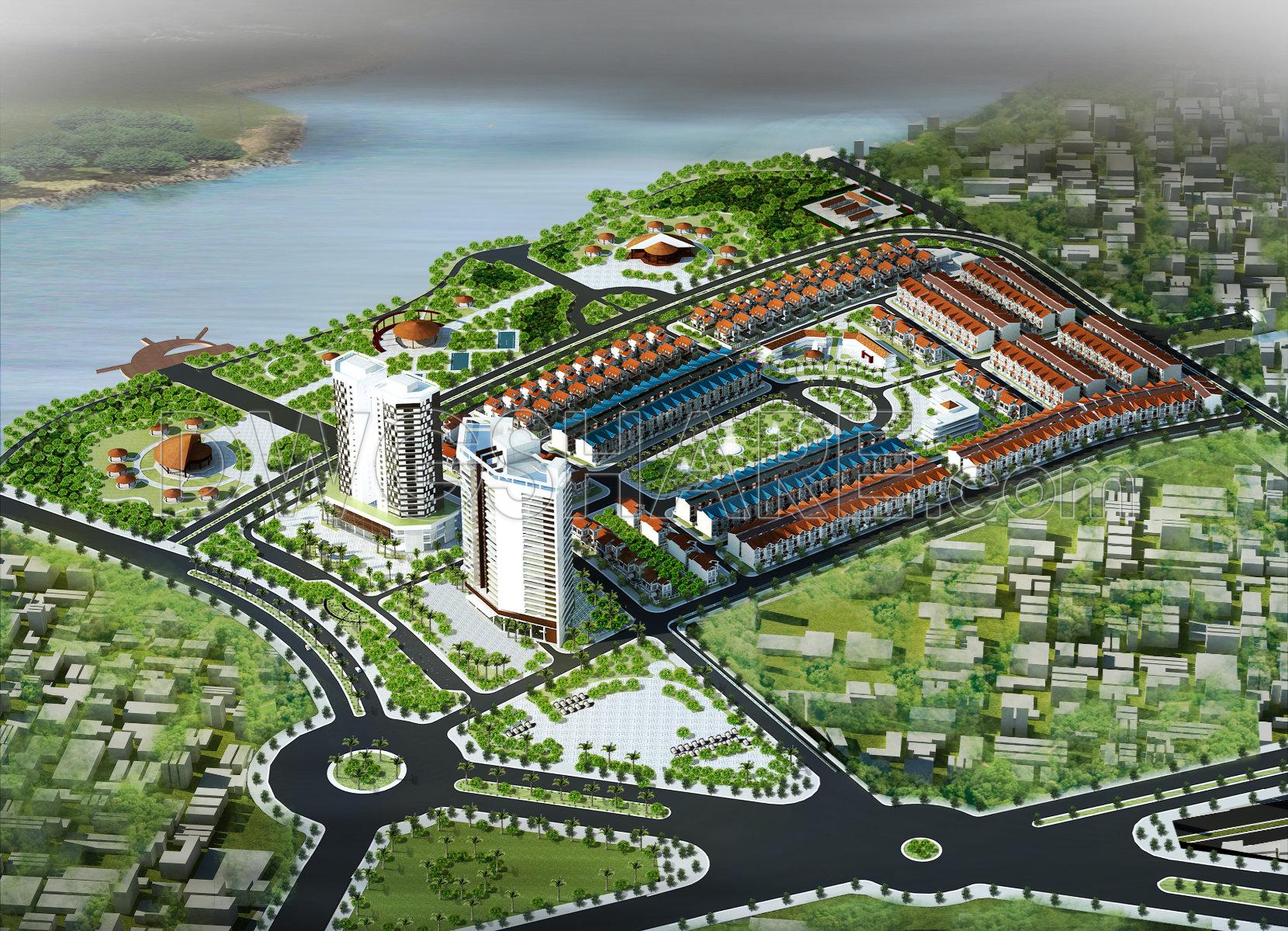
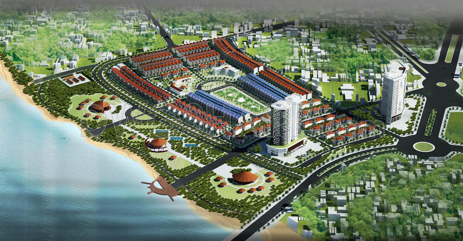
This drawing set presents a comprehensive architectural and landscape spatial planning proposal for the new urban area on the south bank of the Lam River. The master plan illustrates a well-organized urban structure, integrating residential zones, public service buildings, commercial areas, and green open spaces. Key components include townhouse clusters, high-rise apartment buildings, administrative and community facilities, parks, waterfront landscapes, and public plazas.
The transportation network is clearly defined with main arterial roads, internal streets, roundabouts, and pedestrian connections, ensuring efficient circulation and accessibility throughout the site. Landscape design plays a central role, featuring riverside parks, green buffers, recreational areas, and visual corridors toward the water. The 3D rendered perspectives provide an overall view of the spatial organization, architectural form, and harmony between built-up areas and natural elements.
These AutoCAD drawings are suitable for urban planning studies, architectural design references, and professional documentation for new urban development projects.
I also recommend downloading other Urban, Landscaping CAD drawings for your project reference.
- File format: .DWG; .JPG
- Size: 7 MB
- Source: DWGshare
- AutoCAD platform 2018 and later versions. For downloading files there is no need to go through the registration process
Advertisements