

189. Free Download CAD Land Use and Transportation Planning Map of Gia Thuy Ward
Advertisements
189. Free Download CAD Land Use and Transportation Planning Map of Gia Thuy Ward
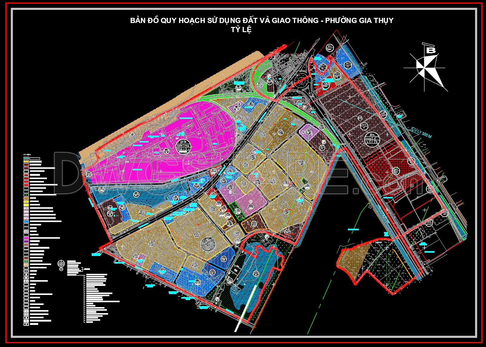
The Land Use and Transportation Planning Map for Gia Thuy Ward presented in this CAD drawing offers a detailed and comprehensive visual representation of urban planning elements essential for city planners and architects. This map includes critical components such as land division, road networks, and zoning information, providing a clear overview of how land within Gia Thuy Ward is utilized and managed.
Functional floor plan layout prominently outlines residential, commercial, and recreational zones, clearly color-coded for immediate understanding. The careful delineation of these areas supports effective urban development by indicating where specific construction is permitted and ensuring a balanced urban environment.
Transportation elements are another focal point, showcasing a network of major and minor roads, along with public transportation routes. These features are integral to the map’s utility, emphasizing connectivity and accessibility within the ward. This type of drawing is vital for architects and urban planners when considering infrastructure development, allowing them to design projects that seamlessly integrate into existing frameworks.
Grid lines, dimensions, and level markers are precisely laid out, providing technical accuracy essential for practical application. These elements serve as invaluable tools for architects and engineers, ensuring that every aspect of planning adheres to the necessary standards and scales. Such details facilitate the easy modification and reuse of CAD drawings in AutoCAD, simplifying collaboration and minimizing errors during both the design phase and onsite execution.
The practical value of this CAD drawing is significant. With high technical accuracy, it enhances coordination between design and construction teams, leading to reduced errors and optimized costs. This free download is particularly beneficial for professionals seeking a dependable base for technical drawing development or students requiring a resource for study and research.
By offering this digital resource as a free download, we aim to empower those involved in the fields of architecture and urban planning. Use it for design reference, enhancing your understanding of Gia Thuy Ward’s urban landscape, or as a foundation for further development in technical drawings.
I also recommend downloading other Urban, Landscaping CAD drawings for your project reference.
- File format: .DWG
- Size: 2 MB
- Source: DWGshare
- AutoCAD platform 2018 and later versions. For downloading files there is no need to go through the registration process
Advertisements