

192. Free Download CAD Land Use and Transportation Planning Map of Ngoc Thuy Ward
Advertisements
192. Free Download CAD Land Use and Transportation Planning Map of Ngoc Thuy Ward
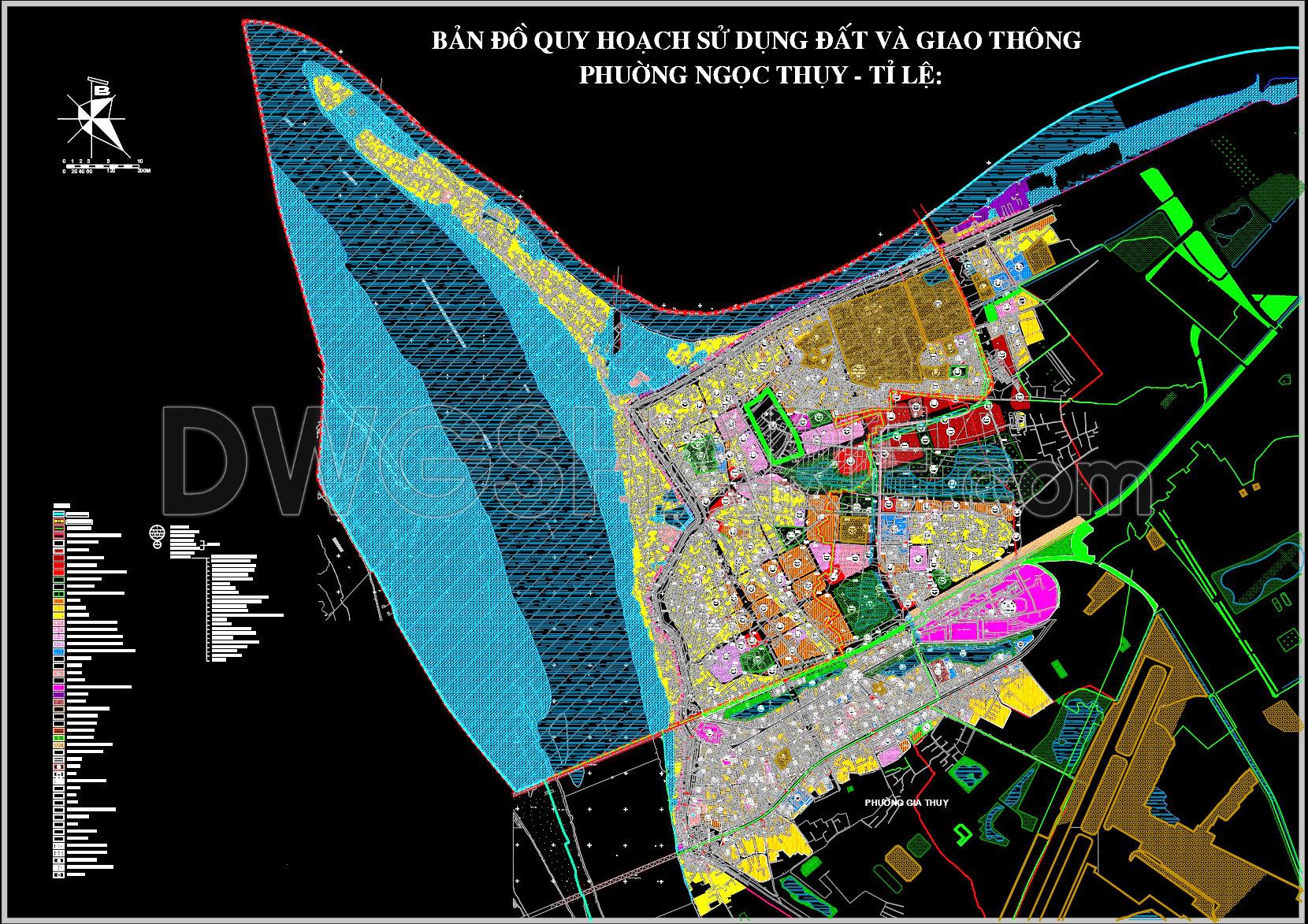
The Land Use and Transportation Planning Map for Ngoc Thuy Ward is an essential resource for professionals in architecture and urban planning. This CAD drawing provides a detailed overview of land allocation, infrastructure, and transportation networks within the ward, offering high technical accuracy essential for both planning and implementation phases. The map distinguishes different zones through color coding, reflecting varied land uses such as residential, commercial, and recreational areas.
Key components of this drawing include:
Functional area outlines that clearly demarcate residential zones, commercial properties, public spaces, and green areas.
Transportation networks depicted with precision, showing main roads, intersections, and future expansion plans.
Infrastructure details like utility lines and public service facilities, crucial for effective urban development.
Such comprehensive mapping allows architects to develop design proposals that align with the existing urban fabric and future planning objectives. It is equally valuable for urban planners aiming to coordinate projects across sectors, ensure sustainable growth, and enhance the community’s quality of life.
Additionally, construction teams rely on these drawings for accurate on-ground execution, ensuring the careful placement and alignment of structures as per zoning laws and infrastructural requirements. The inclusion of grid lines, dimensions, and level markers within the map further facilitates precise measurements and location identifications, which are critical during the construction phase.
These CAD DWG files are indispensable for professionals seeking high-quality base maps for design development. They can be effortlessly modified and reused in AutoCAD, enhancing both productivity and design accuracy. By sharing these files as a free download, the intent is to support ongoing efforts in urban development, offer a rich source for academic study, and serve as a foundation for advanced technical drawing development.
With a focus on reduced errors and cost optimization, these CAD resources lead to improved coordination between design and construction elements, resulting in streamlined project execution and efficient resource management.
I also recommend downloading other Transport CAD drawings for your project reference.
- File format: .DWG
- Size: 5 MB
- Source: DWGshare
- AutoCAD platform 2018 and later versions. For downloading files there is no need to go through the registration process
Advertisements