

184. Download CAD Master Plan of Urban Land Use Planning with Park and Residential Areas
Advertisements
184. Download CAD Master Plan of Urban Land Use Planning with Park and Residential Areas
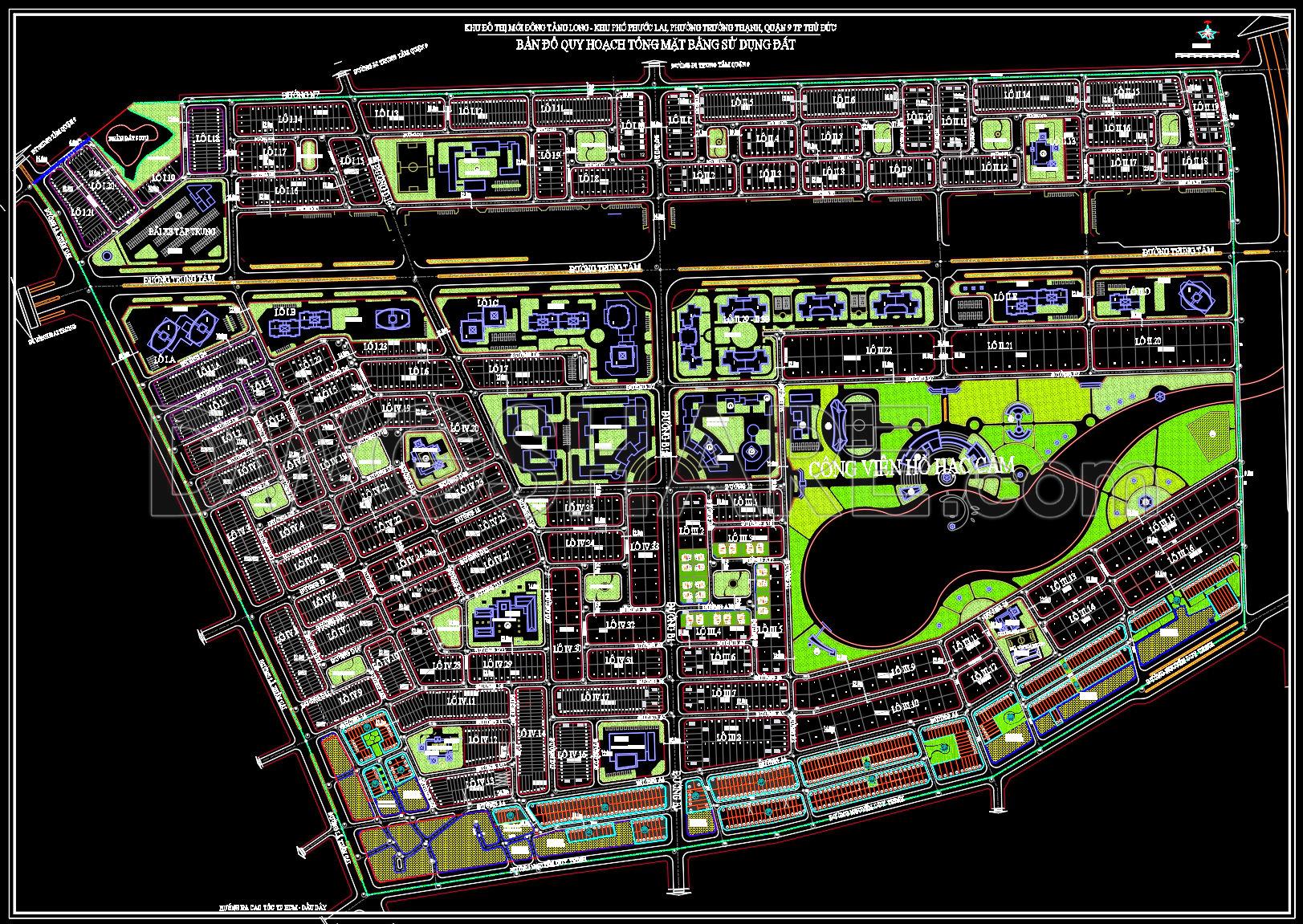
At a glance, this drawing presents a well-organized urban land-use master plan with a clear and easy-to-follow layout. The entire area is structured around a grid-based road network, combined with several main axes running through the site, helping divide land plots in a logical and efficient way.
The most noticeable highlight is the central park with a large lake, acting as both a landscape feature and a communal space for residents. Surrounding this area are clusters of residential and public buildings, arranged with a balanced density rather than being overly crowded.
Each land plot is carefully labeled, showing different functions such as residential areas, service zones, and public facilities. Additional elements like parking areas, schools, and utility buildings are also distributed throughout the plan.
Overall, this is a thoughtfully designed layout that balances transportation, functionality, and livability.
I also recommend downloading other Urban, Landscaping CAD drawings for your project reference.
- File format: .DWG
- Size: 3.12 MB
- Source: DWGshare
- AutoCAD platform 2018 and later versions. For downloading files there is no need to go through the registration process
Advertisements