

185. Free Download CAD Land Use and Transportation Planning Map of Bo De Ward, Hanoi
Advertisements
185. Free Download CAD Land Use and Transportation Planning Map of Bo De Ward, Hanoi
Explore the CAD Land Use and Transportation Planning Map of Bo De Ward, Hanoi
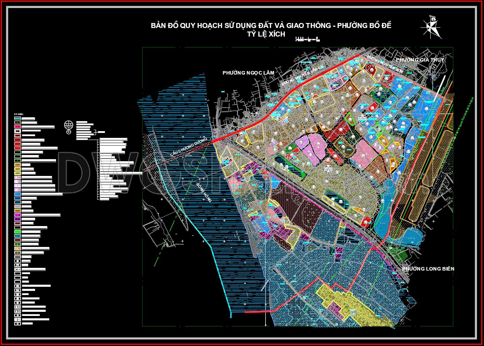
The CAD Land Use and Transportation Planning Map of Bo De Ward, Hanoi is an essential resource for urban planners, architects, and engineers involved in the meticulous planning and development of urban areas. This comprehensive set of CAD drawings provides an in-depth view of the intricate layout of Bo De Ward, highlighting key features vital for effective urban planning.
The primary focus of these CAD drawings is on land use and transportation planning, showcasing a detailed overview of the urban fabric within this area of Hanoi. This map includes several critical components essential for any planning professional:
Functional Land Use Layout: The map illustrates specific zones designated for various types of land use, such as residential, commercial, industrial, and public spaces. This delineation is crucial for understanding how different areas are allocated and utilized within the ward.
Transportation Networks: It features a comprehensive view of the transportation infrastructure, including major roads, streets, and proposed new routes. These details are indispensable for evaluating current and future transportation needs, enhancing connectivity, and ensuring efficient movement throughout the area.
Grid Lines and Dimensions: Clearly defined grid lines and dimensions facilitate precise planning, allowing professionals to accurately measure distances and evaluate spatial relationships between different zones.
Topographical and Boundary Information: The inclusion of topographical data and ward boundaries helps in assessing the geographic and jurisdictional context necessary for informed decision-making and compliance with regional planning regulations.
These drawings serve multiple practical applications. For architects and urban planners, they provide a foundational tool for developing strategic plans, evaluating land use policies, and proposing modifications that align with Hanoi’s urban development goals. Interior designers and construction teams can use these maps as reference points for project coordination, ensuring alignment with overall urban plans and reducing the potential for costly design errors.
One of the significant advantages of these CAD DWG files is their high technical accuracy, which guarantees precision in planning and execution. They are also easily modifiable within AutoCAD, making them highly adaptable for various projects and promoting seamless coordination among stakeholders. This adaptability not only enhances project efficiency but also contributes to cost optimization by minimizing errors during the planning and construction phases.
Available as a free download, these CAD files are invaluable for anyone needing a reliable and detailed reference for design development, study, and research purposes. Urban planners, architects, and students can all benefit from leveraging this resource as a base for further technical drawing development.
I also recommend downloading other Transport CAD drawings for your project reference.
- File format: .DWG
- Size: 4 MB
- Source: DWGshare
- AutoCAD platform 2018 and later versions. For downloading files there is no need to go through the registration process
Advertisements