

188. Free Download CAD Administrative Boundary Map of Giang Bien Ward
Advertisements
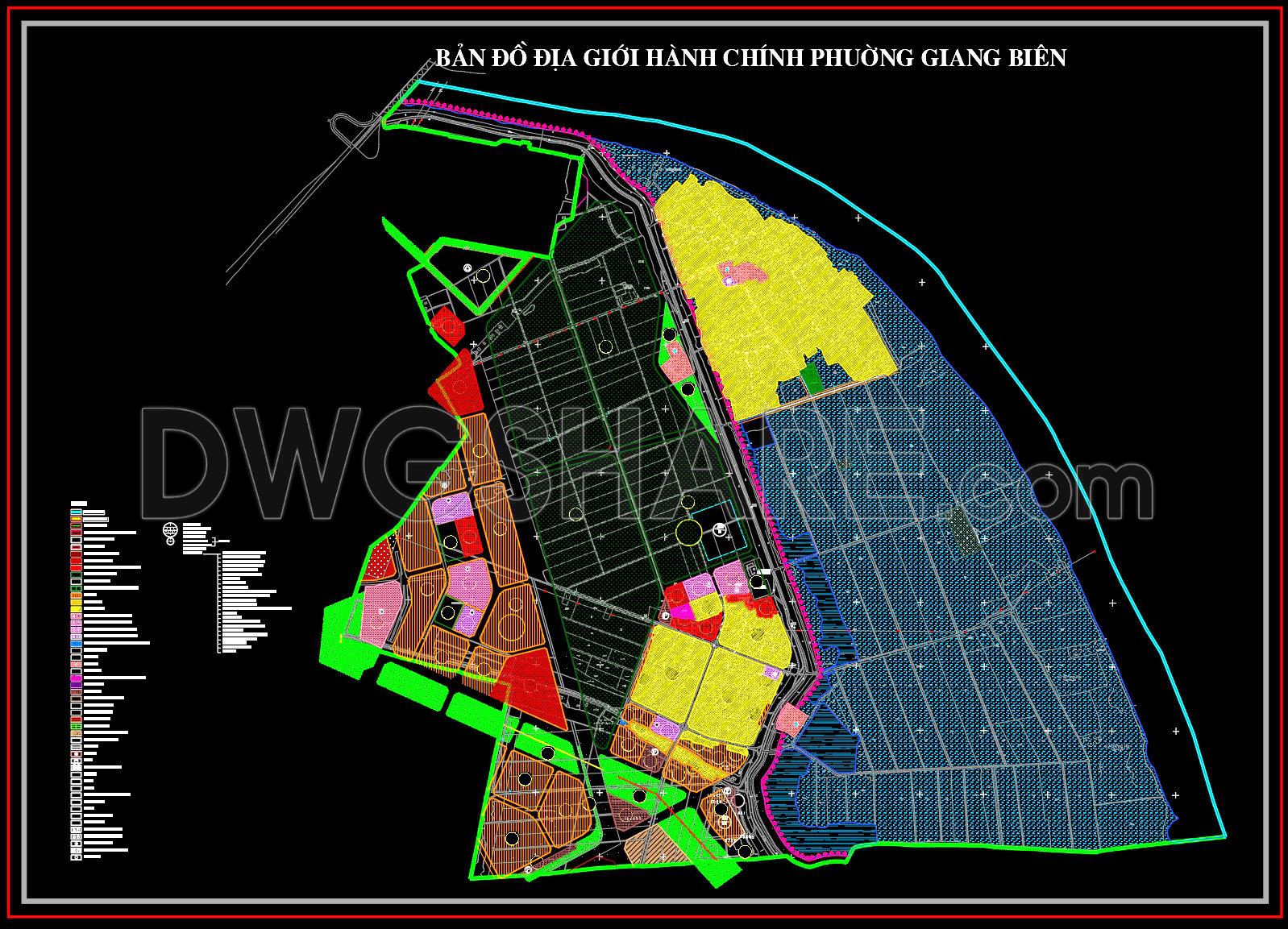
188. Free Download CAD Administrative Boundary Map of Giang Bien Ward
The CAD Administrative Boundary Map of Giang Bien Ward serves as a critical tool for urban planners, architects, and construction professionals involved in the development and management of this area. This detailed administrative boundary map provides a comprehensive layout of Giang Bien Ward, offering crucial insights into its geographic and infrastructural framework.
The primary focus of these administrative boundary drawings is to outline the jurisdictional limits accurately, which is essential for both legal purposes and urban management. Key components visible in the CAD file include:
Clear demarcation of boundary lines and zones
Comprehensive labeling of different areas and plots
Integration of grid lines and level markers for precise measurement
Detailed geographic and infrastructural outlines
These elements are indispensable for professionals who require exact and reliable data to support design development, regulatory planning, and construction coordination. Such maps are fundamental to administrative planning, ensuring that developments adhere to the prescribed boundaries and zoning regulations.
This administrative map of Giang Bien Ward is a critical resource for architects who are in the planning stages of urban developments. By using this data, they can seamlessly incorporate site-specific details into their broader architectural plans. Interior designers find these boundaries valuable when they need to keep design projects within legal limits, ensuring compliance with local regulations.
Construction teams greatly benefit from the precision these CAD drawings provide. They help avoid costly mistakes by offering accurate boundary definitions, assisting in the clear demarcation of construction sites, and enabling better coordination with local governments and stakeholders. This leads to reduced errors and optimized costs.
The practical value of these CAD drawings lies in their high technical accuracy and the ease with which they can be modified and reused in AutoCAD. They facilitate improved coordination between design and construction teams, ensuring that all planned developments are feasible and comply with all necessary regulations.
These CAD files are available for free, making them accessible for a variety of purposes such as design referencing, academic research, and the foundation for further technical drawing development. By downloading this tool, professionals can significantly enhance their project planning and execution processes.
I also recommend downloading other Geography, Maps Archives CAD drawings for your project reference.
- File format: .DWG
- Size: 1 MB
- Source: DWGshare
- AutoCAD platform 2018 and later versions. For downloading files there is no need to go through the registration process
Advertisements