

190. Free Download CAD Land Use and Transportation Planning Map of Long Bien Ward
Advertisements
190. Free Download CAD Land Use and Transportation Planning Map of Long Bien Ward
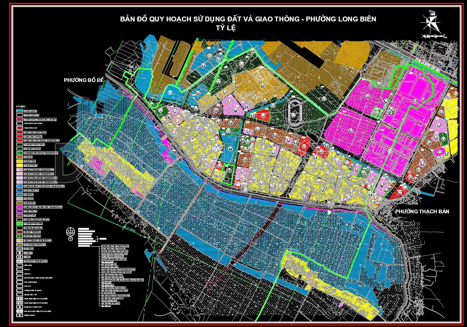
Explore the comprehensive CAD Land Use and Transportation Planning Map for Long Bien Ward. Designed for professionals in architecture and urban planning, this detailed set of CAD drawings provides a meticulous depiction of land use and transportation networks. The primary focus lies on urban planning with precise zoning details, making it an invaluable resource for architects, planners, and researchers interested in urban development.
This planning map includes a variety of essential elements: land use zoning, transportation corridors, and infrastructure layouts. Each component is meticulously detailed, ensuring high technical accuracy that meets professional standards. Land use zoning provides insight into residential, commercial, and industrial areas, facilitating informed decisions in urban design. Transportation corridors illustrate primary and secondary roads, bridging the gap between functionality and accessibility. Infrastructure layouts highlight necessary utilities and resources, guiding effective urban management.
Critical for design development, these drawings serve architects in strategizing spatial arrangements, assist urban planners in ensuring cohesive city growth, and provide engineers with reference points for infrastructural projects. Detailed grid lines, dimensions, and level markers are readily visible, supporting precise scaling and alignment during project execution.
The practical utility of this free download is further enhanced by its adaptability; these CAD drawings are easily modifiable within AutoCAD, allowing for seamless integration and updates in future projects. By promoting improved coordination between design and construction teams, the map optimizes project flow, reduces errors, and curtails costs.
Professionals and students alike will find these files indispensable as a base for technical drawing development, design reference, and academic research. Offering free access to this high-quality resource not only encourages knowledge sharing but also fosters innovation within the community of architects and planners.
I also recommend downloading other Transport CAD drawings for your project reference.
- File format: .DWG
- Size: 5 MB
- Source: DWGshare
- AutoCAD platform 2018 and later versions. For downloading files there is no need to go through the registration process
Advertisements