

155. Download Detailed Construction Planning (1500) – Model Residential Area CAD Drawing
Advertisements
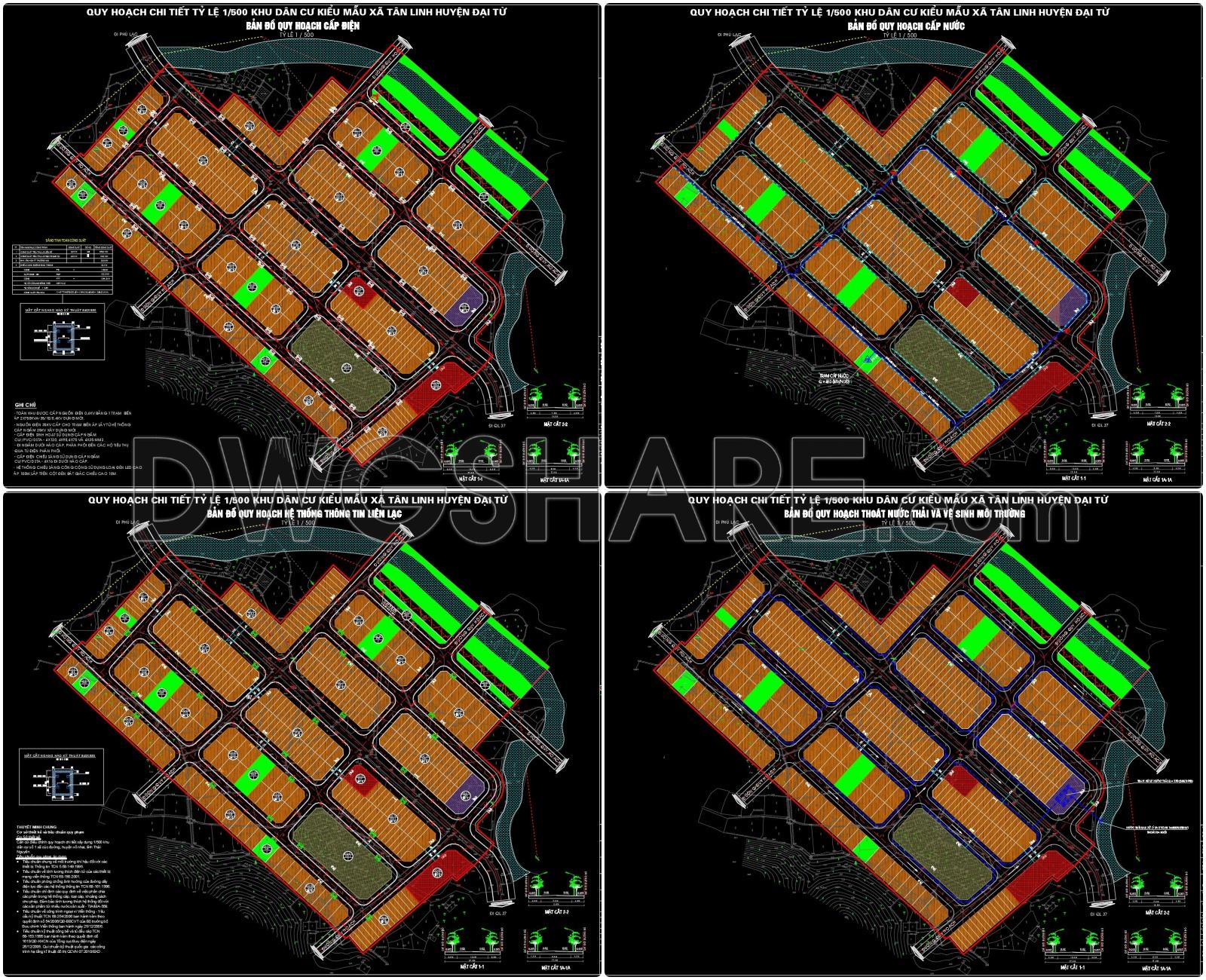
This set of drawings presents the detailed planning of a model residential area in Tan Linh commune, Dai Tu district, at a 1/500 scale, covering various aspects of infrastructure and architecture. The maps are divided into specific categories: electricity supply, water supply, communication systems, wastewater drainage, and environmental sanitation. Each drawing uses clear zoning colors, includes legends, technical symbols, and explanatory notes, making it easy to identify the function of each area.
155. Download Detailed Construction Planning (1500) – Model Residential Area CAD Drawing
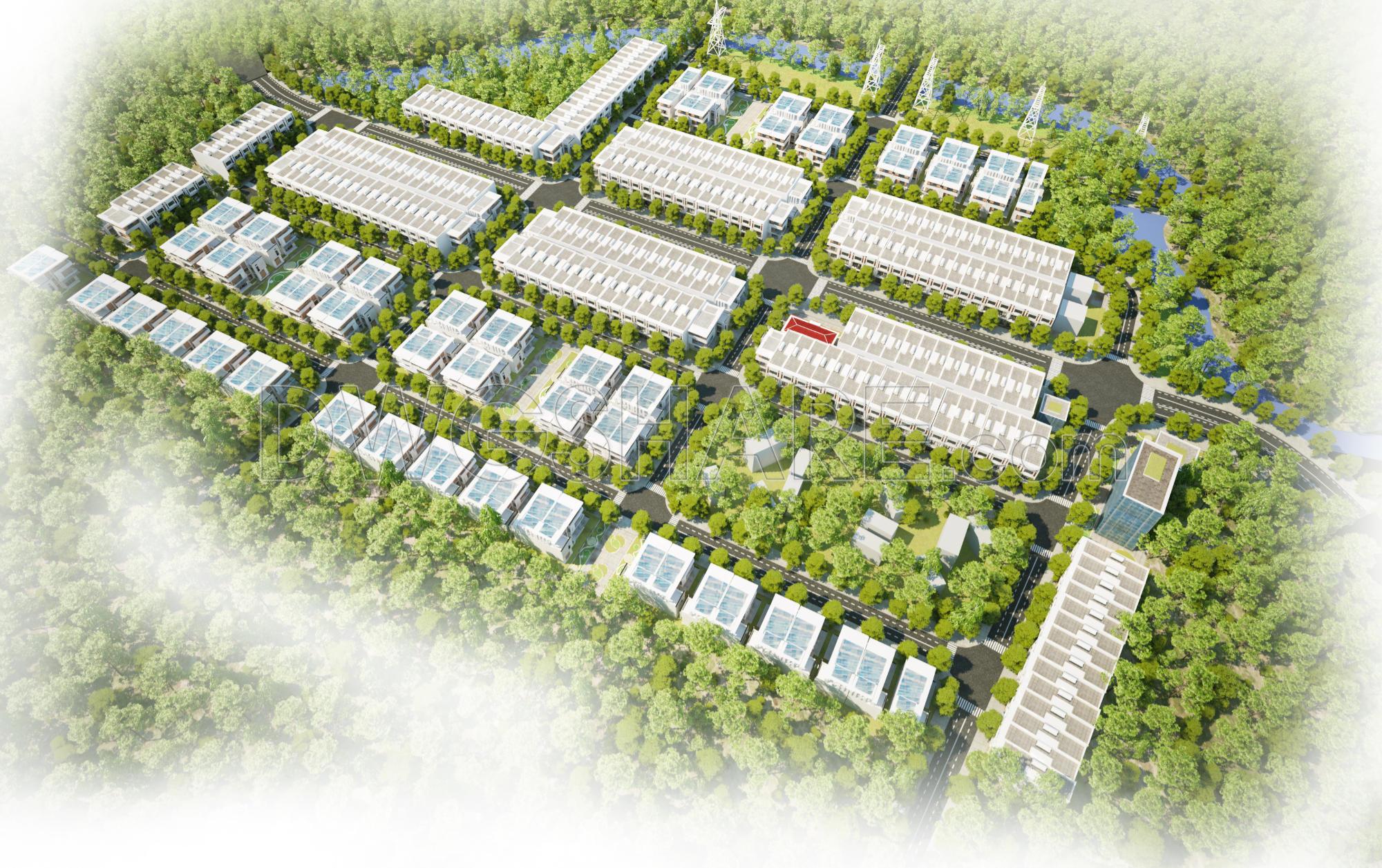
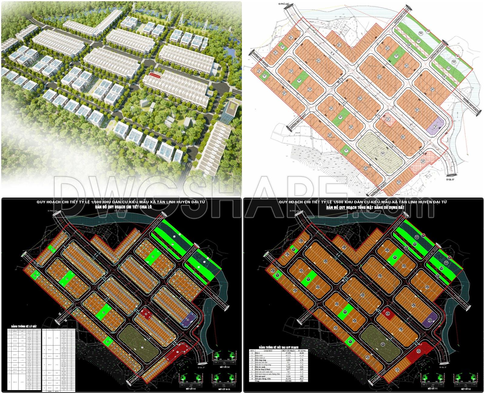
Additionally, the 3D perspective and overall lot division layout clearly illustrate the arrangement of housing units, roads, green spaces, and public amenities. The summary tables of planning area and land classification provide detailed quantitative data, supporting project management and implementation. This is a crucial document in the urban development process, enabling stakeholders to assess feasibility, infrastructure synchronization, and land use efficiency. The drawings are suitable for reference by architects, urban planners, and investors.
I also recommend downloading other Urban, Landscaping CAD drawings for your project reference.
- File format: .DWG: .JPG: .MAX
- Size: 228 MB
- Source: DWGshare
- AutoCAD platform 2018 and later versions. For downloading files there is no need to go through the registration process
Advertisements