

173. Master Planning of the Green Peninsula Eco-Urban Area
Advertisements
173. Master Planning of the Green Peninsula Eco-Urban Area
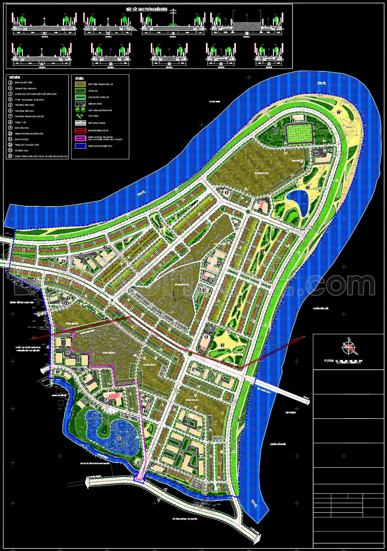
This CAD drawing presents a detailed 1/500 scale planning solution for a modern urban area, uniquely situated on a peninsula surrounded by water on three sides. The most prominent feature of the project is the harmonious integration of technical infrastructure with the natural landscape.
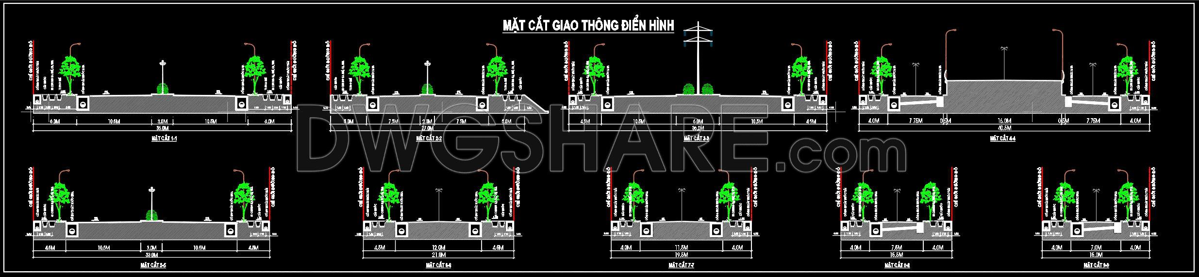
The transportation system is designed in a flexible grid network, ensuring seamless connectivity between functional zones. At the top of the drawing, typical cross-sections are detailed with diverse road widths, incorporating wide sidewalks, greenery, and urban lighting systems.
Regarding functional zoning, the project includes row houses and villas arranged orderly in blocks. Public utility systems are intelligently distributed with a full range of categories:
- Education & Healthcare: Schools of all levels and medical centers are placed in easily accessible locations.
- Landscape & Recreation: Central parks, a regulating lake (No. 12), and riverside green belts optimize the “green living” space.
- Services: Commercial centers, sports areas, and parking lots are strategically positioned to serve residents.
The drawing utilizes a standard planning color-coding system (yellow for residential land, green for vegetation and water, and pink for public land), providing an intuitive vision of a sustainable city focused on quality of life and environmental connection.
I also recommend downloading other Urban, Landscaping CAD drawings for your project reference.
- File format: .DWG
- Size: 3.5 MB
- Source: DWGshare
- AutoCAD platform 2018 and later versions. For downloading files there is no need to go through the registration process
Advertisements