

186. Free Download CAD Land Use and Transportation Planning Map of Cu Khoi Ward, Hanoi
Advertisements
186. Free Download CAD Land Use and Transportation Planning Map of Cu Khoi Ward, Hanoi
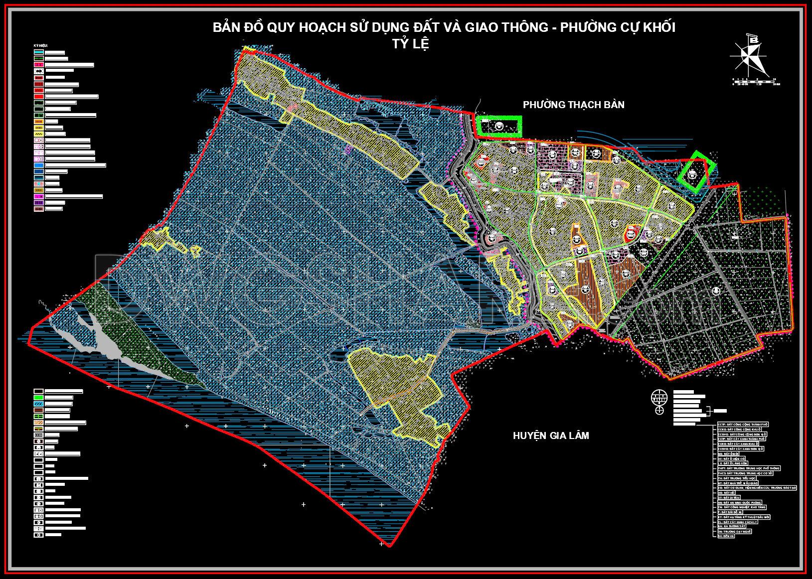
The CAD Land Use and Transportation Planning Map of Cu Khoi Ward is an essential resource for architects, urban planners, and construction professionals seeking a comprehensive understanding of this Hanoi district’s urban layout. This meticulously drafted map showcases detailed land use planning and transportation networks, acting as a crucial tool for both development and research.
The drawing prominently features precise functional layouts, highlighting various land uses such as residential, commercial, and public areas. The transportation infrastructure is clearly delineated, emphasizing major roadways and planned transit routes, enabling seamless urban mobility planning. This clarity in urban demarcation supports architects and urban planners when designing new projects or adapting existing structures.
Key components visible in the drawings include:
- Boundary demarcations detailing the ward’s limits
- Clear zoning classifications for diverse land functionalities
- Notable landmarks and public infrastructure markers
- Detailed network of road grids, aiding in transportation analysis
By providing a clear overview of the planned land use and transportation schema, these drawings serve as valuable blueprints for project conceptualization and execution. Architects can leverage the detailed zoning information to align their designs with existing urban frameworks. Urban planners find this resource indispensable for strategizing developmental policies and optimizing land use.
For construction teams, the explicit grid lines and dimensions facilitate precise on-ground project execution, ensuring alignment with the planned urban landscape and reducing potential errors or design inconsistencies. Additionally, the technical accuracy of these CAD files ensures they are easily modifiable and reusable, boosting efficiency in design modifications and project updates.
This free download of the CAD files offers significant benefits, allowing professionals to use these as a design reference, engage in study and research, or utilize them as a base for technical drawing development. Such accessibility fosters innovation and excellence in architectural and urban planning practices.
I also recommend downloading other Transport CAD drawings for your project reference.
- File format: .DWG
- Size: 3 MB
- Source: DWGshare
- AutoCAD platform 2018 and later versions. For downloading files there is no need to go through the registration process
Advertisements