

658. Structural Geotechnical Cross Section – CAD DWG File
Advertisements
658. Structural Geotechnical Cross Section – CAD DWG File
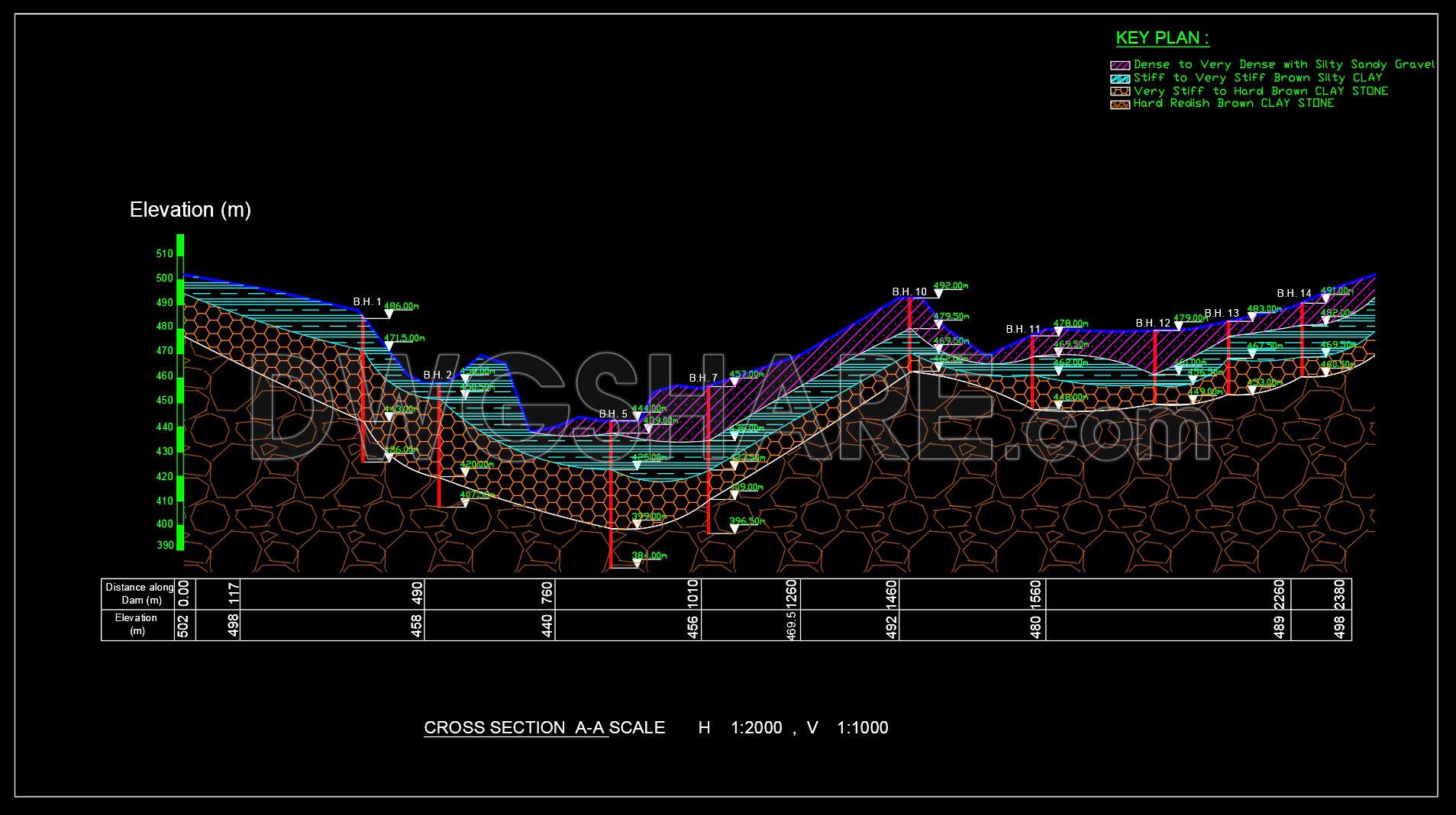
The structural geotechnical cross section CAD drawings provide a comprehensive view of subsurface conditions. These CAD DWG files illustrate multiple perspectives of the same project, capturing critical details for architects and construction engineers. Featuring clear visual representations, the drawings include elevation levels and materials classification, such as dense sandy gravel and stiff clay. Key plan indicators outline the geological layers and their corresponding properties.
These detailed drawings offer practical applications by enhancing understanding of site conditions. The precision of CAD files ensures accuracy in design, making them invaluable for architecture and interior design projects. Benefits include easy editing, smooth collaboration, and cost optimization, supporting efficient project execution. Dimensions marked clearly in the drawings enable precise planning and forecasting.
Sharing these resources for free allows practitioners to utilize them in planning and instructional settings. Access to these files empowers professionals to leverage advanced design strategies. This CAD DWG file series is essential for those seeking to refine their architectural and construction projects. Download these free resources to bolster your project accuracy and efficiency.
I also recommend downloading other Structural CAD drawings for your project reference.
- File format: .DWG
- Size: 2 MB
- Source: DWGshare
- AutoCAD platform 2018 and later versions. For downloading files there is no need to go through the registration process
Advertisements